Photos above and below, taken of Pleistocene Ice Age granite-arkose bould

Misplaced equilateral triangle is not part of boulder series, but ET for Aleutians 7.8M quake of July 22/2020.
ers on Whidbey Island beach wash from Canada show several rotations and polygons as occasional asteroids strike the either side of our Moon:
Libration or “rocking” makes arcuate scribes, and are reinforced with slight expansions later. Linear sides are from Polygons that occur rapidly- as with Strikes. Many other motions of the Moon show that it inflicts many slices and arcs on Earth; now my assessment that North-South alignment of Greenland and the great African Rift are influenced awaits your comments:
Above and below are eruptions which are very close to multiples of 111 km for same day quakes, but at variance due to epicenters being inaccurately placed! Accuracy will return as “wartime help” improves while the virus dies.
Western Pacific’s 4-5+M quakes derive from Atmospheric changes (Heat, monsoons, tropical Storm) and not from 6M+, as from eruptions! These home in on deluges and water mass transfer:
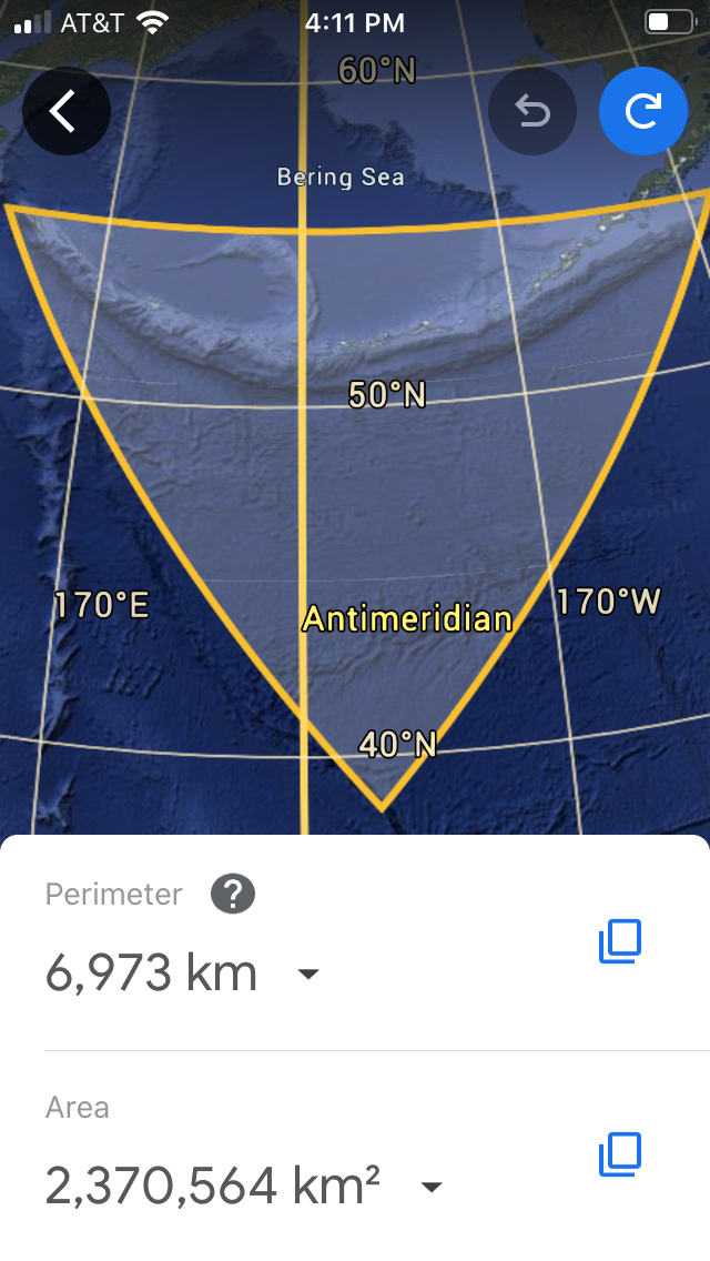
Missing the Vulcanism at small 4.1M quakes, I sought to determine whether they were associated with 6M and larger; large latitudes have distortion on the Mercator projection, so the Aleutians archipelago is tested for both high latitude and low magnitude:
Above and below are results of ET about Bowers subsea ridge, without homing in on an eruption:
Above equilateral triangle leaves High latitude and low magnitude unsettled! I will wait for 6+M to find the solution to the quandary.
Recalculating with a 5.3M stronger quake, results are improved- above and below Bowers ridge has 1,969/3= 656.3 km average, with 9.7 or 1.5 percent deviation:
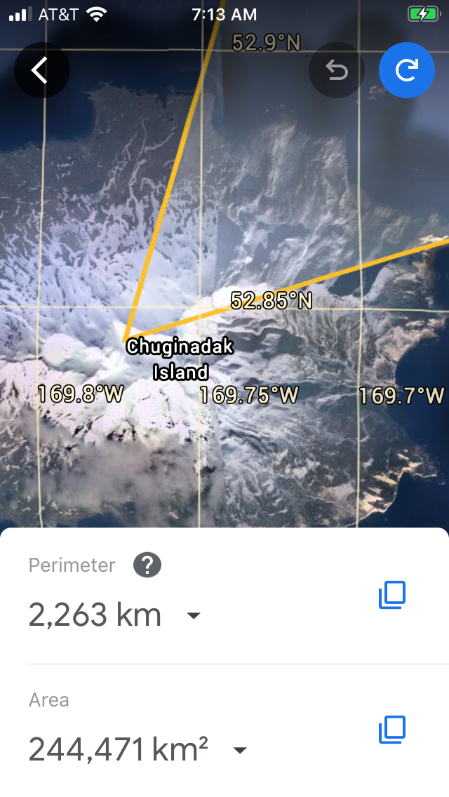
Attu is a volcanic island, and success occurs when the corner occurs on the eruption; it’s important since the reversal likely is 39-40 million year shift of the Kenmei seamount in life Emperor chain:
Continuing- the Bowers reversal is detailed at the corners of ET:

Why do you pick boulders on Earth’s surface to indicate events on our Moon? I have found that it’s second after our Sun in attracting a bulge on Earth- more than at the Equator. Monthly it and Earth oscillate around the Barycenter to create meanders for all streams. 2. Moon has 5.145 degrees Inclination from the ecliptic, and twice monthly crosses it to average being perpendicular to our Sun. 3. Geologists sought Tektites from the Moon for similar reasons. 4. Total eclipses show how the Moon offsets the Sun’s Heat and attraction; and 5. Full and New Moon inflict catastrophes on Earth!
M7.8 on July 22/2020 allowed inspection of the equilateral triangle ET about the High latitude Aleutians as shown above and below:
2,263/3= 755.3 km, or 21.7 or 3/10 percent deviation from 777.
Bering Sea location is the only feature gained at the third corner below.

Conclusions for this case:
1. High latitude and M amount allow a volcanic island to be located;
2. Eruption date is not indicated for this island;
3. Aleutians trench must be separately analyzed for relation to Hawaii’s eruptions- as found previously;
4. High latitudes are not eliminated!
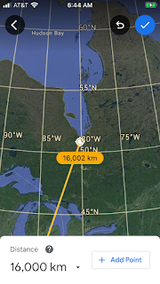
Extending the 7.8M past Bowers ridge, we get another opportunity to solve the Shift at the 39-40 million year Emperor chain enigma; it may connect with the continuing Mendocino transform:
Checking the 7.8M coordinates above, andET below, there’s the


Big picture above shows the
Connection between Emperor chain, Mendocino transform, and Alaskan archipelago is shown- to see how they reacted before the 39-40 million year event; note that Heat must be created across the Right lateral fault, and be distributed continuously, with the provision that it bifurcated after 40 m.y.
Moderate 5.2M possibly is influenced by Iceland’s active Bardurbunga which’s 4,107 km distant:
Distortion at Iceland’s Arctic circle makes the corner above appear a right angle, and below is the distorted triangle:
Conclusions:
1. Avoid Arctic latitudes;
2. 11,939/3= 3,979.7 km, compared to 4,107 has 2.5 percent deviation and is discarded; and
3. Exercise above shows the limit of Mercator projection!
North of Antarctica there is the Sandwich archipelago which has incurred a 6.3M 222 km from Bristol Island. 6.3M has no inhabitants closer than the Falklands- Malvinas:
Location of the 692/3= 230.7 km- which’s 8.7 high, or 4 percent shows the errors at extreme latitudes. Within a week, there have been large M at opposite sites near the Arctic circle and the Moon is marginal; what is the impetus? Venus is to the north, and Jupiter- Saturn’s to the south, and we will proceed on that arrangement:


 Why do you pick boulders on Earth’s surface to indicate events on our Moon? I have found that it’s second after our Sun in attracting a bulge on Earth- more than at the Equator. Monthly it and Earth oscillate around the Barycenter to create meanders for all streams. 2. Moon has 5.145 degrees Inclination from the ecliptic, and twice monthly crosses it to average being perpendicular to our Sun. 3. Geologists sought Tektites from the Moon for similar reasons. 4. Total eclipses show how the Moon offsets the Sun’s Heat and attraction; and 5. Full and New Moon inflict catastrophes on Earth!


 Big picture above shows the


Beautiful blog
ReplyDeletePlease read my post
ReplyDelete