Mendocino transform has Sun Tilt history
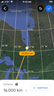
 Our star- the Sun- is a source of Earth's Heat, and radioactive K40 has added more over the longer term than its 4.6 billion life. Sun has projected its changes onto earth continually, including its precessing Tilt, its Magnetic field, Coronal mass ejections CMEs, and Heat for crustal eruptions. Literature 7.25 degrees Tilt changes with time, and can be followed at the Mendocino transform- starting with the 800 km or 7.2 degrees of latitude Separation between the closest two at the California coast, from Mendocino. Start with the next frame:
 Transforms are parallel and 7.2 degrees apart in latitude,7.2 x 40,000/360= 111.111 km/million or 1,000/9 yields 800 km for the first two, and this increases to the West- indicating that our Sun’s tilt was greater in the past.
 Next frame shows the increased to the west and it becomes less parallel to the next transform. 40N parallel is the main reference for all frames:
 Next frame shows that the Hawaii Emperor chain is to the west and a divergence occurs to form 2 tracks for the chain. Study the silted catastrophe for clues to its incipience to determine whether it’s a crater, reversal of rotation, or transfer of the 39 m.y. Philippines crater.
  Enlarging to see Hawaii’s volcanodiscovery.com where there’re more reasons to discard the “mantle plumes” assertions, and to investigate the 2 tracks- which are forming side-by-side basaltic eruptions from the top of the mantle.
  Enlarging with 40N latitude as the local reference, Mendocino transform disappears, and all are adjacent to the Hawaii Emperor chain; 40 million years age Kenmei is the Prime Reference and it’s associated with the termination at 13,333.33 km (1/3rd of circumference) S. America orb and Lake Titicaca anomaly.
  Hawaii’s Pu’u Kilauea flow of 2018 occurred with a 7.1M Marianas Archipelago quake- transmitted 6,000 km through brittle crust to Hawaii. Flow continued for months and confidence is low for this association.
We have found that the Mendocino transform has terminated at the 40N anomaly, and has made the Pacific’s coast above it reverse and create the Cascades volcanodiscovery.com
Reverse Tides, eg Mt. St. Helens 1980 killer of 59; seamounts were re-oriented as subsea eruptions, and our Sun’s Tilt change has created major anomalies. No relationship to the 75 percent Indonesia’s blasting volcanoes has been found:


 Sumatra’s older and has less volcanoes, but more earthquake.usgs.gov and tsunamis; age then is an important factor for volcanodiscovery.com
Lake Toba is the 770,000 year exception- being a graben and collapse feature. Hot springs still exist there, and it’s one for the unknown future:

 Lake Toba is near the Equator where 40,000/360 degrees is 111.111 km/degree, and may be used in all directions for locations near it. 44 km Samosir is near change of .4 degrees latitude and location may have some bearing on extrusions. Valles and Yellowstone are 2 Super-volcanos on 2 corners of the Colorado Plateau of 41 million years age. Pleistocene mass shift may have initiated the Toba super eruption?
Black hole below in sand hollow, Hurricane, Utah below:

 Protrusion may look like a volcanic cone, but it’s a Mima Mound. WA state park is named after the farmer who tilled the fertile soil, and I included it because it rises under the influence of the Ice Age mass shift- same as eruptions on a much larger scale. Plants grow better at the top, since the soil works even after the ice withdrawal. I observed some fracturing concrete recently, and it can be seen closeup without the heat of eruptions! Called other names in areas without the ice age, it’s a model for Earth’s surface disruption:
 Galactic plane is shown horizontally even though it’s at 60 degree angle to the Ecliptic.
  Note the layered pattern of Lake Toba beds of ash and hardened debris from the eruption; NW trend is the orientation of the lake, and the collapse has them vertically arranged.
  Remember Paricutin during WWII? It appeared in a Mexican farmer’s field, as he worked- watching a puff of steam in a level cornfield! Gradually the entire village was abandoned to this cone.

Now that you see the “Big picture”, follow my explanation why the bulge occurs from 0-10S. Water covers 90 percent of the Southern Hemisphere, since Australia and S. Africa are the main contributors of 2.7 grams/cc Crust (1.0 for rainwater), and the density divider is south of the geometric equator. Sumatra, with Lake Toba, to E. Indonesia is an ellipse which moves easterly between the two Cratons of Australia and Kalimantan (no quakes or volcanoes in stable A or K), and the movement is to the east from oldest Sumatra. Caught between the two, extension southward of the expanding archipelago causes mass to be shoved upward in rising magma-Volcanoes. Except for Sumatra and Sulawesi they are south of the geometric Equator; this continues with Papua to the east with Lake Victoria having Vulcanism on either side- at Africa’s Equator. Right angles to each other of the African Rift and Indonesia’s West to East Movement occurs with a quarter turn of the Globe. Rift will be addressed in a new submission. Main conclusion now is that the combination of our Sun’s placing more Heat and the Vertical shove of mass between the two cratons produces eruptions!
 Lake Victoria is 30E, compared to Kalimantan’s 120E- a 90 degrees difference (orthogonal), where a quarter turn of Earth turns a lateral > into a vertical ^, as is the case of Kalimantan’s versus Lake Victoria’s; all this happens in the Crust- where blasting silicates (think of glassblowing) occur, vs the Mantle- where flowing Basalts ooze. This suggests that both Merapi, Java and Nayiragungo are violent, when Erta Ale and Kilauea are not!
 I
I
 Sakurajima (cherry blossom island) at high latitude is not explained with previous analyses, and these cold temperature eruptions have another discussion:
 Aleutians expand southward, same as Indonesia’s Archipelago,but Sun’s Heat is minimal, so I will find whether the Bering Sea is a stable mini-craton. None to the south to retard it, and the archipelago must be shoved by something besides T or C! Moon works N-South and is 2.16 times as forceful. It goes further to the north than our Sun, and can be the lift that creates eruptions?
 Diomedes are near the divider of the shrinking Pacific’s width and I have calculated it to be 169.6W of arbitrary Greenwich Zero longitude. Bering sea isn’t a mini-craton, but a Terrace silted from the Gold-bearing Yukon! Next is seen the relationship of our Moon- which can show above the Arctic circle at 66.561N, and on the horizon at the North Pole:
 Noticing that a plane view on flat Google Earth has many figure 8s, NASA has now made a photo of a Space 3 dimensional 8 of an asteroid or solid rock. Two masses have collided to produce this rarity:

 Geologists have “muddied the waters” of the Atlantic ridge to produce many calculated Ages of the MAR! Read the texts to find that it’s 16,30, or my guess of 100-200 million years; rate of 20 mm/year is helpful, as that’s the one I find for the Pacific. Iceland’s NW corner is 16, and the rise started long before that, so we’re back to 30 million or more.
  Diomedes are near 170W from Greenwich and at the change of Bering to Pacific Oceans; they are the Natural Zero meridian as calculated by the close approach of a space mass:
 Semisopchnoi is near Bowers ridge shown, and has jerks today, as well ashfall; our Sun is visible south of the Arctic circle at 66.561N when it’s summer (not now), and the Gibbous Moon is dominant by 2.16 gravitational Ratio. New Moon of 23rd February isn’t the culprit, but there’s only an ashfall.
Wondering if the Galactic plane shown at 60 degrees tilt to the Ecliptic influences the eruption, but this is for demonstration only.


 Bukit Kelam- near Sintang, Kalimantan’s Inselberg (island rock), is almost due north of Java’s Merapi- the most active of Indonesia’s volcanoes. Distance divided by 20 mm/year was corrected by this measure to 21.744. Now, we still have to determine how to predict the next eruption when the last interval was 16 months after 2018! I calculate that it will occur in March/2020- “Beware the ides of March”!
  Separation of Merapi from Merbabu (Maid mountain) can be used to calculate dormant to active stage.
  Photo of vertically-arranged rocks aren’t Inselbergs, but planet Mars bars! It has no magnetic field, so has no earthquake.usgs.gov
 Septarian, or “Turtle Rock” is stressed limestone CaCO3 which has filled the fractures with precipitate as Earth rotates and vibrates. This was found in Cretaceous outcrop at Eagle Nest ridge, New Mexico:
 Prediction of next Merapi eruption is for March, so “Beware the ides of March:
The Galaxy will “clam up” on the 60 degree inclination of the Galactic plane- relative to the Ecliptic. No relation is known for this gravitational attraction to Earth, but my perception is that “everything is connected to all else”:

 Since I am relating Merapi to the Inselberg in Kalimantan, it popped up today- pertaining to last week 2 days before the February 9/2020 Full Moon^.
 Ontong Java is an atoll- largest known, and it must derive from an underlying eruption- it has little to do with Java, Indonesia.

Comments
Post a Comment