Archipelagoes preceded by smaller ones yield 5 anomaly times


Youngest of the Archipelagoes is the Antilles Martinique shown with 2,400 km separation from the Florida Keys- a Pleistocene feature; ratio of 4,444/2,400 can be used to get a preliminary age of the older one.


Testing the 5,998/3= 1,999 km which started with 2,222-sided triangle, displacement is 223 km shy, or 10 percent, and unacceptable! Chose another attempt shown below:


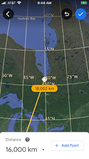
3,372/3=1124- which’s 125 over and no better! IPad isn’t the right tool for the analysis, and below the photo is more information.


Conjecture that Sudbury crater in Northeast Canada was the instigator of the older archipelago, literature has information about the 
1.85 billion year crater- which yields an age to the PreCambrian feature.

Diameter was not in the 111 km-sided ET, and this is shown in the Triangle below 2 frames down.
Above is the east corner with circular seamounts, and below is the north where Marianas inflections give way to the Ogasawara sequence:


Is the Cascade trend an archipelago? No- pelagic is the “open seas”; an arc in the ocean pertains to Indonesia and others. Below is the northmost Garibaldi volcano in Canada, of the Cascades. Below that shows the triangle from Mt Lassen to Garibaldi; interesting is that it corners with Yellowstone 1,083 km distant:


Why is the Equilateral triangle ET so accurate, and what is the Dark Energy driving it? Big picture of the America’s ET may solve this- starting with the prime Reference Mendocino 40.439N latitude below:


 Big picture above includes both the Atlantic and Pacific Oceans, and cuts across Costa Rica’s Arenal- ol’sandy- which I visited via Elderhostel (now Road scholar) and was tossed a boulder from Arenal- which missed, so that I can relate that it was from Earth’s crust, and not from the mantle’s basalt. This partly confirms that Dark energy works from the top, and not from Geo “mantle plumes”! See the Costa Rica twist below:


Comments
Post a Comment